November 1947: the Gilgit rebellion
When British India was partitioned in August 1947, the Gilgit region technically belonged to the Maharaja of Jammu and Kashmir, who acceded his state to India that October. The local response was swift: on the first of November 1947, the Gilgit Scouts — a locally recruited frontier corps — rose against the Maharaja's governor in Gilgit and declared for Pakistan.
The rebellion, led by local officers with broad popular support, was over in days and almost bloodless in Gilgit itself; harder fighting followed through 1948 as local forces pushed east into Baltistan, taking Skardu and reaching the passes toward Ladakh before the 1949 ceasefire froze the lines. The Mirs of Hunza and Nagar acceded to Pakistan in the same November weeks.
For travelers, the legacy is woven into the trip: the first of November is marked across the region as Independence Day, the Gilgit Scouts' successors still serve in the mountains, and the ceasefire line of 1949 — today's Line of Control — is the reason the old roads east to Ladakh remain closed and all routes funnel south to Islamabad or north to China.
The Northern Areas: remote by definition
For decades after 1947, the region was administered directly from Islamabad as the 'Northern Areas' — a name that said everything about how distant it felt. The princely states of Hunza and Nagar kept internal self-rule until 1974, there was no constitutional assembly, and the whole region's connection to the outside world was a jeep track over the Babusar Pass, open a few months a year, plus a weather-dependent air link to Gilgit.
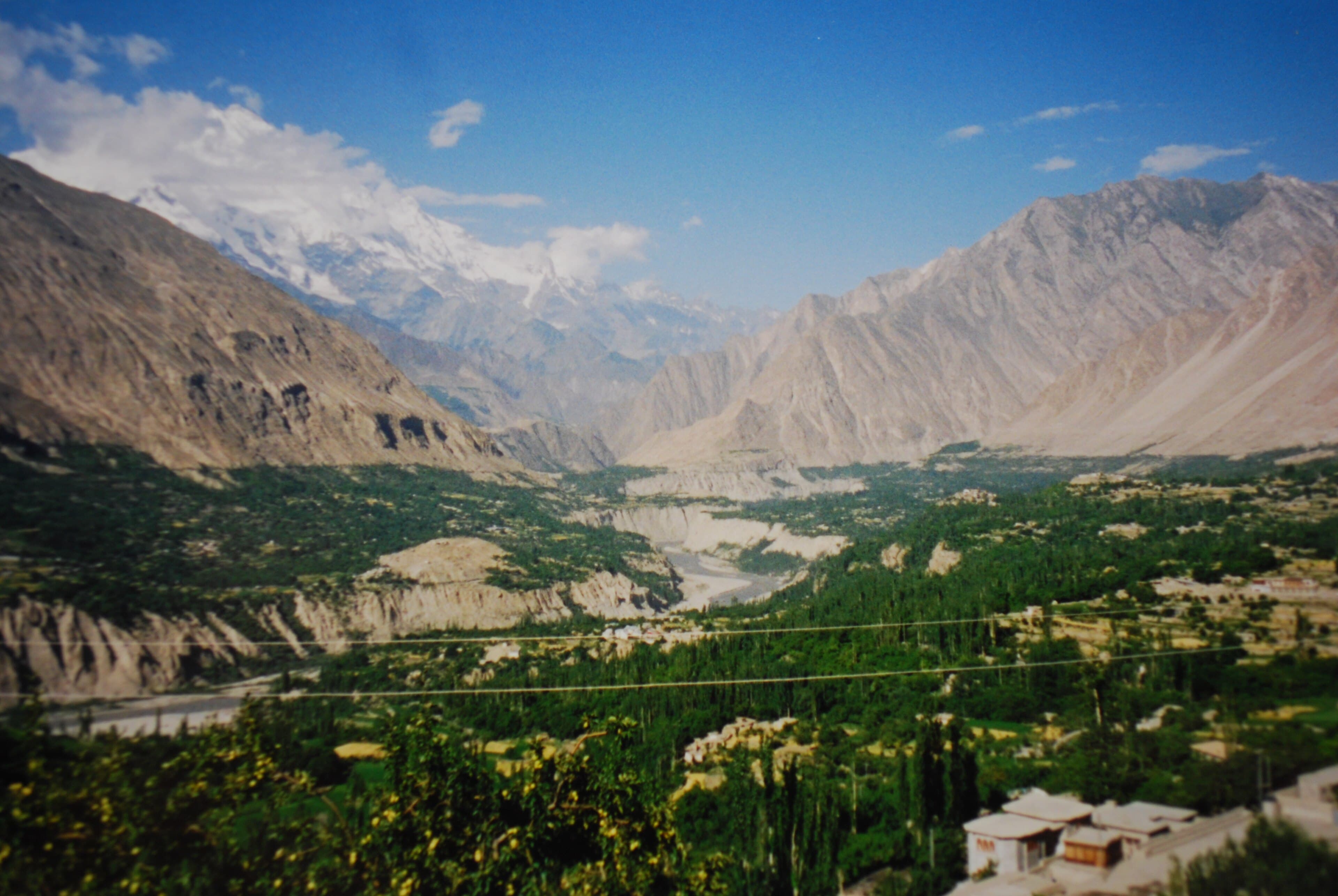
Isolation shaped everything. Valleys grew what they ate, salt and cloth came up by mule, and a bad harvest meant a hard winter. Older people in Hunza and Baltistan still describe pre-road life vividly — and their stories explain the region's deep, practical enthusiasm for every road, bridge and airport built since.
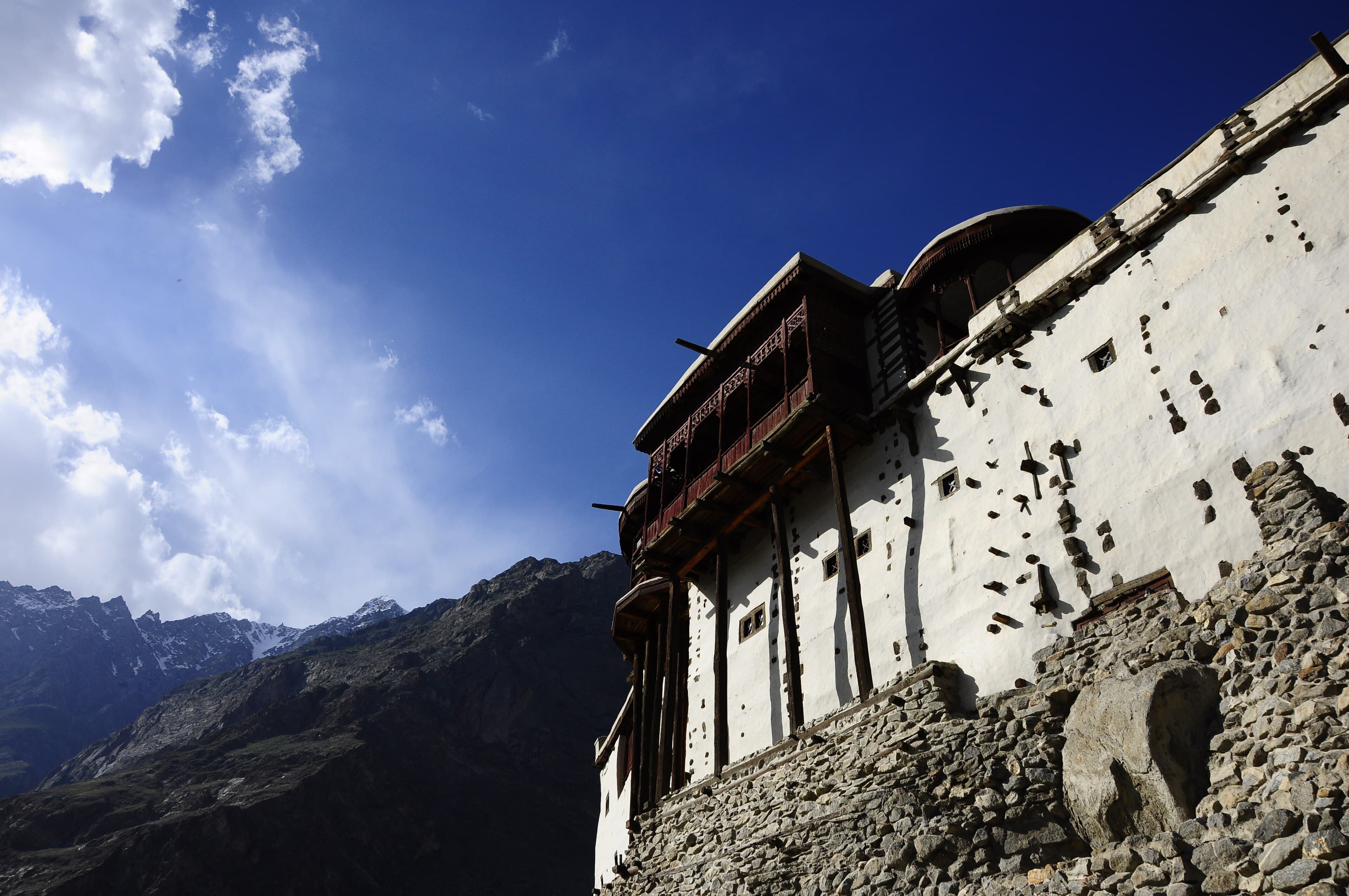
It also preserved what travelers now come to see. The old forts, terraced field systems, languages and festivals of Gilgit-Baltistan survived the twentieth century partly because the twentieth century took so long to arrive.
Building the impossible road: the KKH, 1966–1978
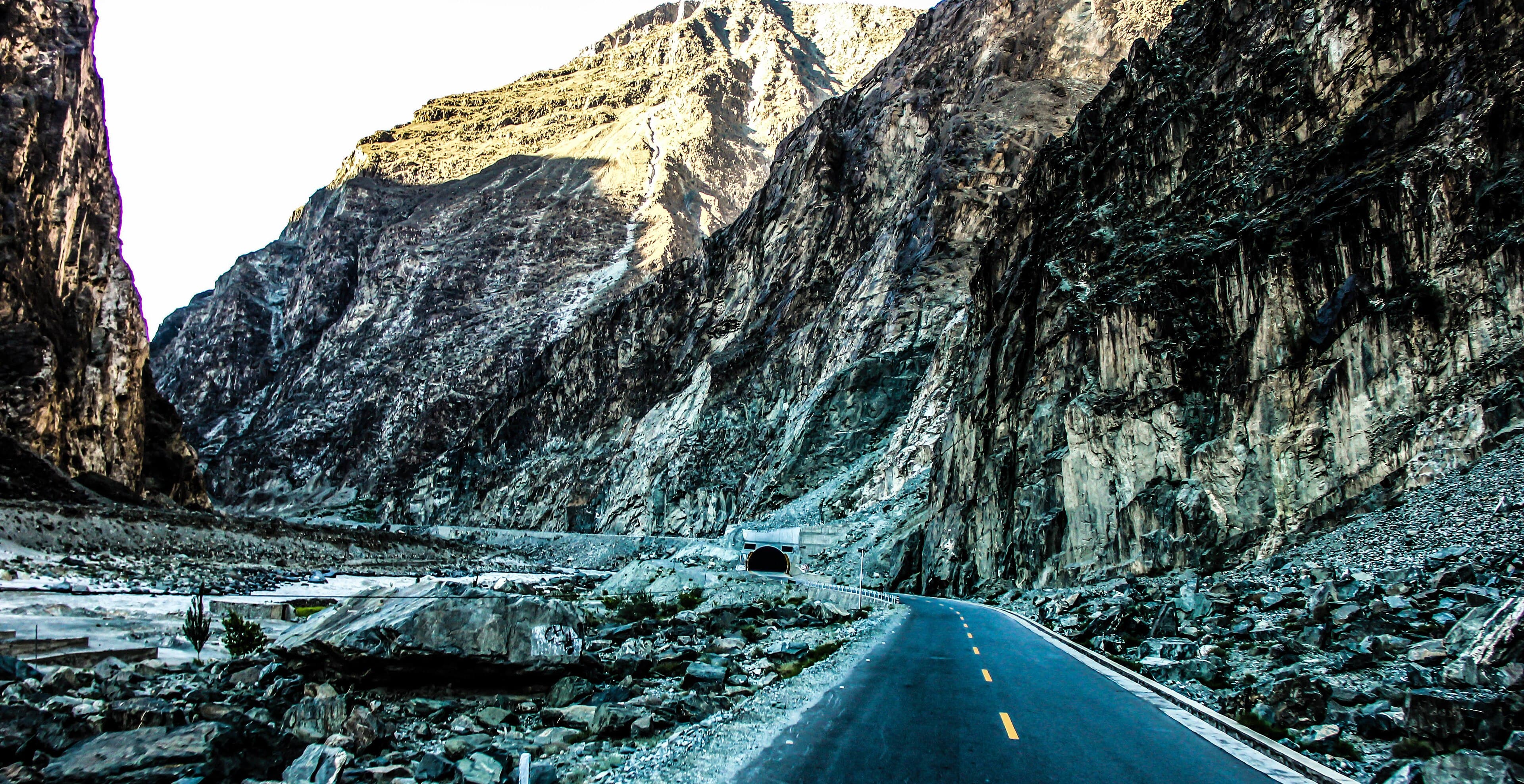
Everything changed with the Karakoram Highway. Between 1966 and 1978, Pakistani and Chinese engineers and soldiers blasted a two-lane road through some of the most unstable mountain terrain on earth, from the plains near Islamabad over the 4,693-metre Khunjerab Pass to Kashgar — a project so audacious it's still called the eighth wonder of the world in both countries.
The cost was paid in lives. Landslides, rockfall and accidents killed hundreds of Pakistani and Chinese workers over the construction years — a sacrifice commemorated at monuments along the route, including the Chinese cemetery at Danyor near Gilgit, where Chinese workers who died on the project lie buried and which Chinese visitors still honour today.
When the highway opened fully in 1978, journeys that had taken weeks became a day's drive. Wheat, cement, medicine and ideas rolled up the gorge; apricots, potatoes and gemstones rolled down. No single event in the region's modern history — political or otherwise — changed daily life as much as this road.
Opening to the world: the first tourism boom
Through the late 1970s and 1980s, the valleys opened to travelers in earnest. The KKH became a legendary overland route, backpackers rode the new NATCO buses up from Rawalpindi, and the government progressively eased permit rules that had kept foreigners out of the high valleys. Inns and guesthouses appeared in Karimabad, Gilgit and Skardu, often in family homes.
Mountaineering boomed in parallel. The Karakoram's giants — closed to expeditions for years around the 1960s — drew the world's best climbers back, and the 1980s and 1990s became a golden age of Karakoram alpinism, with Baltoro expeditions employing thousands of Balti porters each summer and trekkers following the climbers in to Concordia and K2 Base Camp.
By the 1990s, Hunza and Skardu sat firmly on the world's adventure-travel map: a place where you could ride one of the world's great roads, sleep under Rakaposhi, and walk to the foot of K2 — all on a shoestring. Many of today's leading local tour operators and guiding families got their start in exactly those years.
The hard years: Kargil, 9/11 and empty guesthouses
The boom met two shocks in quick succession. The Kargil conflict of 1999, fought across the Line of Control east of the region, put northern Pakistan in headlines for the wrong reasons; then the post-9/11 years collapsed Western tourism to Pakistan almost entirely, as advisories hardened and flights and insurance grew complicated. Through the 2000s, guesthouses that had been full every summer stood largely empty.
The region itself remained what it had always been — calm, hospitable and far from any front line — but it paid the price of distant events and a national image problem. Families who had invested in tourism switched back to farming or sought work down-country; some of the era's hotels still carry a faded 1990s time-capsule charm.
Those lean decades explain something visitors often sense: how personally people in Hunza and Skardu take tourism's return. When a community has watched its livelihood vanish for reasons it had nothing to do with, every returning traveler feels like vindication — and is treated accordingly.
Attabad: the lake that rerouted the highway
On the fourth of January 2010, a mountainside collapsed onto the village of Attabad in upper Hunza, killing villagers and damming the Hunza River. Over the following months the rising water drowned villages and nineteen kilometres of the Karakoram Highway, severing the road link to China and cutting upper Gojal off from the rest of the country except by boat.
For five years, all traffic — passengers, cement, Chinese trade containers — crossed the new lake on barges, an improvised system both photogenic and miserable in winter. The fix came in 2015, when Chinese-built realignment tunnels (about seven kilometres of them) opened around the lake, restoring the highway and incidentally giving the KKH its smoothest section.
The disaster's strange afterlife is now part of every Hunza itinerary: Attabad Lake's turquoise water has become one of Pakistan's most photographed places, ringed by boat jetties and lakeside resorts. Locals hold both truths at once — grief for the buried village and gratitude for the livelihood the lake now provides — and it's worth remembering both when you visit.
A name and an assembly: the 2009 reforms
In 2009, the Gilgit-Baltistan Empowerment and Self-Governance Order finally retired the colonial-flavoured 'Northern Areas' label and gave the region its present name, along with an elected Legislative Assembly, a chief minister and a governor. It was the biggest constitutional step in the region's history, even though Gilgit-Baltistan's final status remains linked to the wider, unresolved Kashmir question.
For visitors the practical effects are simple: you are travelling in a region with its own government, assembly and budget, increasingly run by a young, educated generation — Gilgit-Baltistan's literacy and education levels, especially in Hunza, rank among Pakistan's best. Local political life is lively and overwhelmingly focused on development: roads, electricity, schools and tourism.
Identity here is layered and worn easily: people are proudly Balti, Burusho, Wakhi or Shina-speaking, proudly Gilgit-Baltistani, and proudly Pakistani hosts. Travelers who ask respectful questions will find people happy to explain the region's distinctive history and status — usually over tea.
The revival — and what this history means for your trip
From around 2015, tourism came roaring back. Improved security nationally, the new Attabad tunnels, social media's discovery of Hunza's blossoms and Skardu's deserts, and a wave of domestic Pakistani travelers transformed the region's economy; international visitors followed, helped by easier e-visas and, since 2021, Skardu's upgraded international airport and reliable jet service to Islamabad alongside Gilgit's air link.
Hotels, glamping resorts and cafés have multiplied at a pace that occasionally outruns planning, and conversations about managing growth — zoning, waste, water — are now part of local politics. The best operators and communities are pushing for quality over volume, heritage conservation and trekking standards, and travelers who book locally support exactly that.
Read the landscape with this history and everything clicks: the checkpoints (legacy of a frontier region that keeps its guests safe), the brand-new hotels beside 1990s inns (two tourism booms, one gap), the Chinese trucks at Sost (the Silk Road's latest costume), and the genuine warmth of your hosts — people who know precisely what it means when the world stops, and starts, coming to visit.
Questions, answered
When did Gilgit-Baltistan become part of Pakistan?
In November 1947, when the Gilgit Scouts rebelled against the Maharaja of Kashmir's governor and declared for Pakistan, followed by the accession of Hunza and Nagar and a 1948 campaign that brought Baltistan in. The region was long administered as the 'Northern Areas' and received its current name and elected assembly in 2009.
How many people died building the Karakoram Highway?
Hundreds of Pakistani and Chinese workers died during the highway's construction between 1966 and 1978, mainly in landslides and rockfall — commonly summarised as roughly one life per kilometre on the hardest sections. Memorials along the route, including the Chinese cemetery at Danyor near Gilgit, honour them.
What happened at Attabad in 2010?
A massive landslide buried part of Attabad village in upper Hunza in January 2010, killing villagers and damming the Hunza River. The rising lake drowned 19 km of the Karakoram Highway, which was rerouted through Chinese-built tunnels opened in 2015 — and the turquoise Attabad Lake is now a major attraction.
Is Gilgit-Baltistan a province of Pakistan?
Not formally. Since the 2009 reforms it has been a self-governing administrative region with its own elected assembly and chief minister, but its constitutional status remains linked to the unresolved Kashmir question. For travelers this is academic — access is straightforward on a standard Pakistani tourist visa.
Why does tourism matter so much to people in Gilgit-Baltistan?
Because the region lived through a tourism collapse after the 1999 Kargil conflict and 9/11, when guesthouses stood empty for over a decade despite the valleys themselves staying calm. The post-2015 revival rebuilt livelihoods, so communities are deeply invested in visitors having a safe, excellent trip.